This morning's routine was similar to yesterdays with the exception of putting our luggage in the van to be transported to our next destination.
Todays ride began our Ring of Kerry expedition. It was a bit shorter than yesterday's ride with about 1,000 less feet of climbing. Fortunately, we began with sun! Don't get too excited, though, because we had sun, rain, and YES, GALE WINDS on our last 600 feet of climbing! She is following us!


Here's Team Ireland 2015 with our matching jerseys!

First stop was in a cute little town called Sneem. DARLING! We stopped for a coffee at the halfway point.


Off we went! Mitch and I have been doing most of our riding with our friends Dan & Karen Ray......that is when Dan doesn't leave us in the dust!


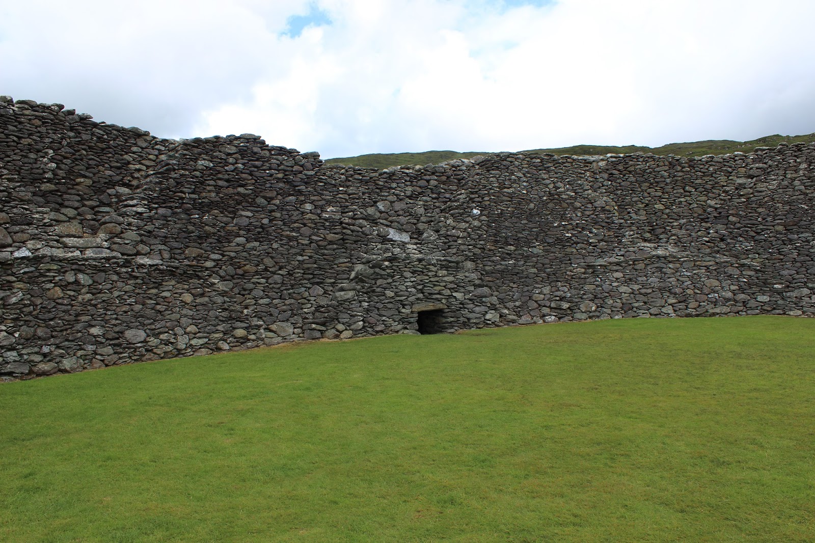
We took a fun detour to see the Staigue Fort.
Three miles NNE of the Sneem-Parknasilla road is Staigue Fort, one of the largest and finest ring forts you are likely to see in Ireland. It stands on a low hill in an amphiteatre of rugged hills open to the sea on the south.
The wall is up to 5.5m (18ft) high and 4m (13ft) thick, surrounding a circular area of 27.4m (90ft) in diameter. Inside the wall are two small chambers about 2.1m (7ft) high, oval in shape and waterproof, with a corbelled roof of the type also used in the much earlier passage grave at Newgrange. The interior of the fort is reached through a 1.8m (6ft) high passage roofed with enormous double lintels. Access to the ramparts is gained by a series of steps in the shape of the letter X.
The fort is surrounded by a large bank and ditch, still very obvious on the north side. Staigue Fort shows great skill in building. No mortar was used, the stones were not dressed and it is similar in style to the Grianan of Aileach in Co. Donegal. The dating of this site is difficult but it may have been built in the centuries preceding St Patrick, during the Celtic period. Dr Peter Harbison, however, suggests that the earliest possible date for construction is probably around the first century BC.
During the 19th century its construction was in turn assigned to such unlikely groups as Phoenicians, Cyclopeans, Danes, and Arch-Druids, while equally implausible theories were put forward concerning its purpose. Local lore has it that the inhabitants were small in stature and they came here in search of ore. There is evidence that copper was excavated in the surrounding countryside.


These pictures below were exactly how I pictured Ireland. Amazing beauty!


Finally arrived in Waterville. We rode 45 miles today, climbed 2,802 feet, and were on our bikes for 4 hours and 21 minutes. Another day with a 10 mile an hour average speed. Yes, those winds are something else!!
Below is our view from our hotel room. GORGEOUS! Tomorrow (weather permitting) we are riding to the dock and taking a boat out to the Skelig Island.


The town of Waterville.


Our amazing sunset tonight with our hotel in the background.
No comments:
Post a Comment